Nineteen year ago I started this blog as a distraction from my father’s heart attack and slow recovery. It was late 2004 and social media & video streaming apps didn’t exist yet — or at least not widely available to the general public. Blogs were the newest means of …
The new NGA West campus , Jefferson & Cass, has been under construction for a few years now. Next NGA West is a large-scale construction project that will build a new facility for the National Geospatial-Intelligence Agency in St. Louis, Missouri.This $1.7B project is managed by the U.S. Army …
Book publisher Island Press always impresses me with thoughtful new books written by people working to solve current problems — the subjects are important ones for urbanists and policy makers to be familiar and actively discussing. These four books are presented in the order I received them. ‘Justice and …
This post is about two indirectly related topics: the new Siteman Cancer Center building under construction on the Washington University School of Medicine/BJC campus and an update on my stage 4 kidney cancer. Let’s deal with the latter first. You may have noticed I’ve not posted in three months, …
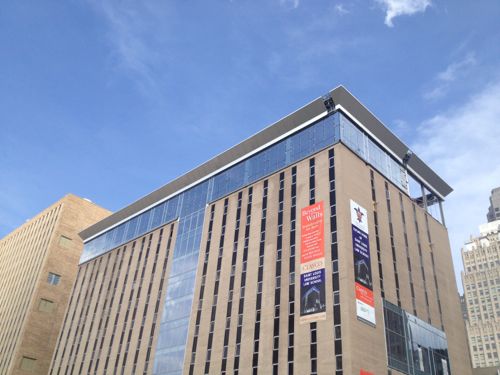
Last month (April 2013) the exterior of the new law school was basically complete, with new glass elements and a new top floor.
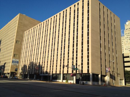
The same building in September 2012
But this post isn’t about the alterations to the building, this post is meant to help faculty, staff & students understand how to use the MetroBus system.
The distance between the current law school on the main SLU campus and the new building is 2.3 miles via Lindell/Olive & Tucker. Driving time is 9 minutes end to end, but no parking is available at the ends, so walking time needs to be added.
Taking the #10 (Gravois Lindell) MetroBus is 16 minutes, per Google Maps, including walking time. Time on the bus is 11 minutes plus 5 for walking, so taking the bus is competitive with driving in this example.
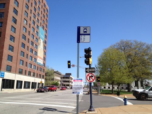
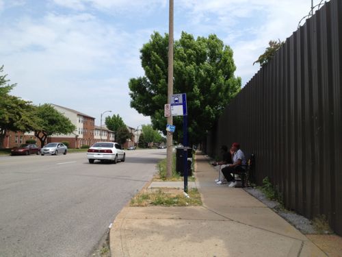
Those going from the main campus can catch the #10 in one of two places: on Lindell east of Spring or Lindell east of Grand. You’ll exit the bus on just after it turns on 14th St., next to the Ford Building.
Riders returning the SLU main campus can catch the #10 at this bus stop at 14th & Pine, the Ford Building at left is the stop for those going to the law school.
In the opposite direction you’ll walk two blocks west along Pine to the stop shown above. You can exit at Grand to Spring for the main campus.
Frequency is every 30 minutes, 40 minutes after 11pm. The #10 line is the bus I use most often, the 30 minute frequency isn’t a problem when you know the schedule. I personally don’t use the printed schedule, I just check the times on the Google Maps iPhone app (or online) as needed.
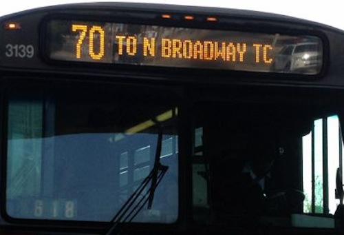
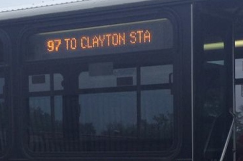
The bus route number is shown on the front left followed by the the final destination. This example is the #70 (Grand) MetroBus heading NB.
The route number & destination is also displayed on the curb side of the bus, just behind the door.
Here are some other things to remember:
Make sure you look for your bus, if you are busy reading the bus driver may not realize you want to board and pass you.
Transfers offer a good value. Say you board the bus at 10:30am and pay $3 ($2 fare + $1 transfer), you’ll get a transfer good until 1pm!
Bus drivers can’t offer change, so having $1 bills is a good idea, a monthly pass is $72. Hopefully a new SLU administration will join the Metro campus programs like St. Louis Community College, Washington University, and University of Missouri-St. Louis (UMSL).
Let others get off the bus before boarding, when you exit use the back door rather than the front door. This reduces delays.
You’ll need to pull the cord to signal you want to stop at the next bus stop.
Don’t be afraid to sit toward the back, the front seats must be given up for elderly & disabled passengers.
Other MetroBus lines within 2 blocks of the law school include: 30, 41, 74, 94, 97, 99. Four blocks away at 14th & Market adds the 4 & 11.
A majority of readers favor Trailnet’s suggestions to focus on transit, biking, and walking efforts to reduce automobile congestion:
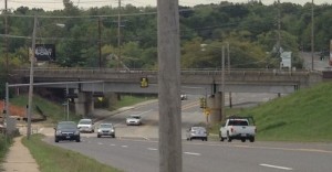
South Hanley ducks under railroad tracks.
Q: How should St. Louis County reduce auto congestion between Hanley & Watson?
Focus on transit, bicycling and walking solutions 60 [57.14%]
Build proposed “South County Connector” partially-elevated roadway 25 [23.81%]
Do nothing 16 [15.24%]
Unsure/no opinion 4 [3.81%]
The pro-Trailnet crowd combined with the “do nothing” group total a whopping 72.38% that didn’t select the built it option.
A public meeting will be held Thursday May 30th.
The South County Connector Draft Environmental Impact Statement (EIS) will be available for public review and comment from Friday, May 3, 2013 to July 19, 2013. During the review period, the St. Louis County Department of Highways and Traffic will host a public hearing for the Draft EIS on Thursday, May 30, 2013 from 4:00 p.m. to 8:00 p.m. at the Shrewsbury City Center (located at 5200 Shrewsbury Avenue, Shrewsbury, Missouri 63119).
The public hearing is an opportunity for interested persons to give testimony concerning the Draft EIS, including potential social, economic, and environmental impacts of the proposed roadway alternatives. Representatives of the South County Connector Study Team will also be available to provide information and answer questions about the Draft EIS at an open house meeting held at the same time as the public hearing. No formal presentation will be made. Display boards and copies of the Draft EIS will be available for review at the open house meeting. (South County Connector)
If you are among those who don’t think this project should move forward please contact all of the following:
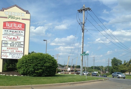
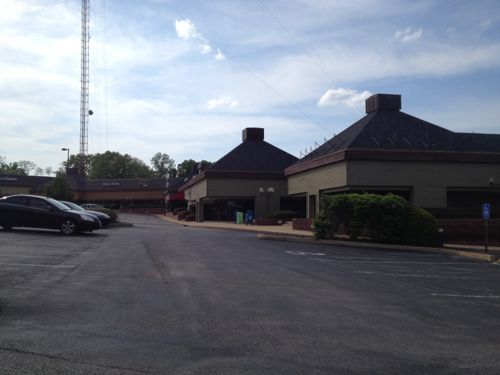
I’m not a fan of Walmart, but this post isn’t an attack on the Walmart business model. Instead the purpose of this post is to show how the redevelopment of Kenrick Plaza (map), proposed by G. J. Grewe, as presented, will not meet the minimum requirements of the Americans with Disability Act of 1990 (ADA).
First let’s take a quick look at the area:
Sign for Kenrick Plaza at Watson Rd and Trianon Parkway Drive, looking east
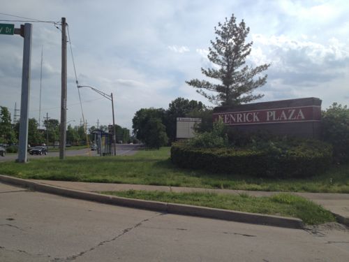
Sign at Trianon Parkway Drive, looking west
b
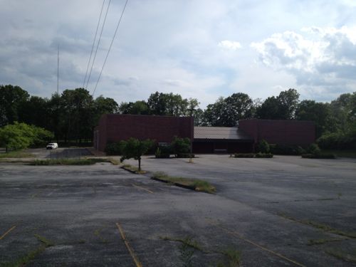
The now-closed Kenrick Cinema is located on the west side of Trianon Parkway.
A report prepared by PGAV details how Kenrick Plaza is in bad physical condition, the layout doesn’t work well (former Burger King blocks views of retail space behind, etc.) and it doesn’t work for people with disabilities.
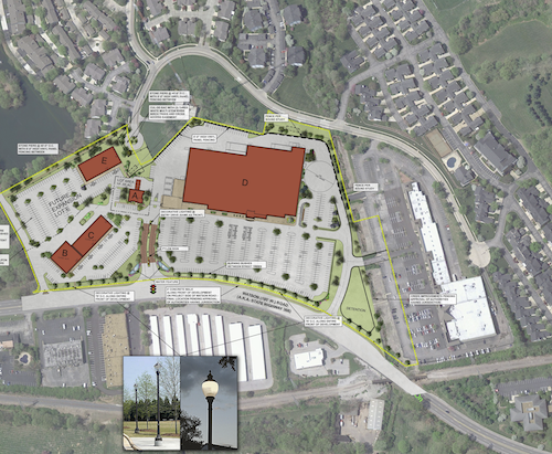
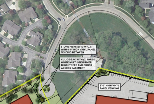
Here’s the proposed site plan, which includes cutting off public access to Watson Rd for many houses, leaving one entrance off of Laclede Station as the sole way in and out, with an exception for cutting through the private “lower Kenrick Plaza” area.
Proposed site plan, click image to view larger version on Scribd.
The Comprehensive Plan for the City of Shrewsbury (the “Comprehensive Plan”) dated March 1970, designates the land use for the Area to be commercial. The Comprehensive Plan, drafted as the Kenrick Seminary lands became open for development, envisioned the land uses immediately adjacent to Watson Road as a commercial corridor that would bring the City’s percentage of commercial land up to 10.4% from a meager 3%. The City was heavily dominated by residential and institutional uses and lacked significant commercial acreage.
The Comprehensive Plan was followed in the original construction of Kenrick Plaza as a commercial district supporting the surrounding residential development that largely lacked retail, entertainment, and restaurant options within close proximity. Also accommodated in the Comprehensive Plan was the construction of one or more television towers. This redevelopment plan maintains the Area as commercial land use consistent with the Comprehensive Plan and accommodates the existing television tower. The map depicting future land use included in the Comprehensive Plan specifically and clearly designates the Area for commercial land use.
Oh good, it complies with the 1970 “Comprehensive Plan”! Apparently nothing in Shrewsbury has changed in the last 43 years. I want to point out a few big red flags about this proposal:
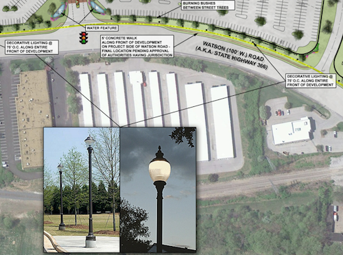
A sidewalk along Watson Rd with “decorative lighting” every 75 feet but you must walk in the auto driveways if you want to shop.
Residents used to driving/walking to Watson Rd will no longer be able to do so, nor can they or their kids/grandkids walk to the store to get bread & milk.
View looking south toward Watson along Trianon Parkway from the last side side street before access to be cut off.
Shrewsbury should be requiring more connections, not fewer.
206 Accessible Routes
206.1 General. Accessible routes shall be provided in accordance with 206 and shall comply with Chapter 4.
206.2 Where Required. Accessible routes shall be provided where required by 206.2.
206.2.1 Site Arrival Points. At least one accessible route shall be provided within the site from accessible parking spaces and accessible passenger loading zones; public streets and sidewalks; and public transportation stops to the accessible building or facility entrance they serve.
EXCEPTIONS:
1. Where exceptions for alterations to qualified historic buildings or facilities are permitted by 202.5, no more than one accessible route from a site arrival point to an accessible entrance shall be required.
2. An accessible route shall not be required between site arrival points and the building or facility entrance if the only means of access between them is a vehicular way not providing pedestrian access.
Advisory 206.2.1 Site Arrival Points. Each site arrival point must be connected by an accessible route to the accessible building entrance or entrances served. Where two or more similar site arrival points, such as bus stops, serve the same accessible entrance or entrances, both bus stops must be on accessible routes. In addition, the accessible routes must serve all of the accessible entrances on the site.
Advisory 206.2.1 Site Arrival Points Exception 2. Access from site arrival points may include vehicular ways. Where a vehicular way, or a portion of a vehicular way, is provided for pedestrian trvel, such as within a shopping center or shopping mall parking lot, this exception does not apply.
206.2.2 Within a Site. At least one accessible route shall connect accessible buildings, accessible facilities, accessible elements, and accessible spaces that are on the same site.
EXCEPTION: An accessible route shall not be required between accessible buildings, accessible facilities, accessible elements, and accessible spaces if the only means of access between them is a vehicular way not providing pedestrian access.
Advisory 206.2.2 Within a Site. An accessible route is required to connect to the boundary of each area of sport activity. Examples of areas of sport activity include: soccer fields, basketball courts, baseball fields, running tracks, skating rinks, and the area surrounding a piece of gymnastic equipment. While the size of an area of sport activity may vary from sport to sport, each includes only the space needed to play. Where multiple sports fields or courts are provided, an accessible route is required to each field or area of sport activity. (2010 ADA Standards)
In short this says it is ok to require pedestrians to use an auto drive to a facility like a Starbuck’s but that exception isn’t applicable to a shopping center. Elsewhere in the same link as above, the term “shopping center” is defined as:
(A) A building housing five or more sales or rental establishments; or
(B) A series of buildings on a common site, either under common ownership or common control or developed either as one project or as a series of related projects, housing five or more sales or rental establishments. For purposes of this section, places of public accommodation of the types listed in paragraph (5) of the definition of “place of public accommodation” in section § 36.104 are considered sales or rental establishments. The facility housing a “shopping center or shopping mall” only includes floor levels housing at least one sales or rental establishment, or any floor level designed or intended for use by at least one sales or rental establishment.
Developer G. J. Grewe and Architect TRi should be ashamed for submitting such a plan, this isn’t 1970 despite the fact Shrewsbury’s comprehensive plan hasn’t been updated.
As I was finishing this post yesterday I received an email from Shrewsbury Mayor Felicity indicating “accessibility is being addressed with sidewalks from the bus stop to the stores.” The site plan on the Shrewsbury website is a preliminary concept. I requested an updated copy but I have not received it.
UPDATE 5/22/2013 @ 3:30pm:
At 3pm I received from Shrewsbury Director of Administration, Jonathan Greever, a PDF copy of “of the current special use permit site plan. This document is limited in that it does not address the entire site and its intended use is not for construction. The purpose for this document is different than that of a fully engineered plan. As stated previously, the final engineered plans have not been generated.” You can view it on Scribd here.
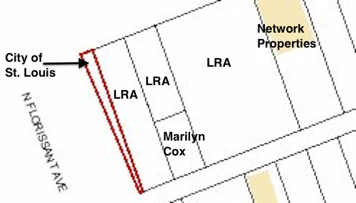
In the first two parts of this series on development sites along a proposed streetcar route I looked at Olive from 15th-16th and Olive from 16th-18th. In both cases it was a small area and I looked a specific buildings and parcels of land. Heading to N. Florissant Ave. & St. Louis Ave. nearly everything is a development site.
Let’s start downtown and work our way north. At 14th & Olive you have the library on the NE corner and the library administration building & a charter high school on the NW corner. I think the library admin building has office space available for lease.
The parking lot at 14th & Locust is privately owned, a good candidate for new construction. Photo is from 2007 before the charter school added another floor to their space on the left.
1400 Washington has had numerous development plans, it is now becoming a parking lot, same owner as the previous lot across the alley.
I’d like to see these two buildings on Washington Ave west of 14th get renovated, along with a thin wedge between the east wall and 14th. Photo from 2011.
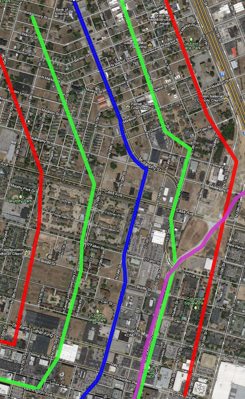
Before we go any further north it makes sense to look at the route on a map along with a development zone on each side of the line. Light rail has stations miles apart, whereas streetcars are more like buses by having more frequent stops along the route.
The blue line is the proposed streetcar route, green about 660ft (1/8th mile) and the red about 1,320ft (1/4 mile). Purple is the new bridge connecting into Tucker. Click to view in Google Maps.
The area between the green lines is the immediate area that I estimate to be part of a special transportation district with slightly higher property taxes, pro-rated based on distance. The red lines are a quarter mile distance, the usual distance a person is willing to walk.
Quite a bit of this area is in what will be one of the Northside Regeneration job centers.
Numerous parking lots occupy significant land north of Washington Ave, ideal candidates for new construction.
A former BarnesCare building built in 2001, is now vacant. With no pedestrian access and large setbacks from both MLK & 14th this building should be razed and a new urban building constructed on the site.
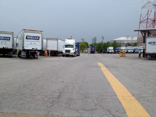
Hogan Trucking uses two city blocks, Carr St has been vacated. Interestingly the property owner is listed as Hogan Redevelopment Corp.
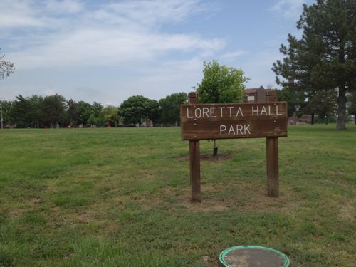
This site must legally remain a public park, as it has been since 1842. Click image for more information.
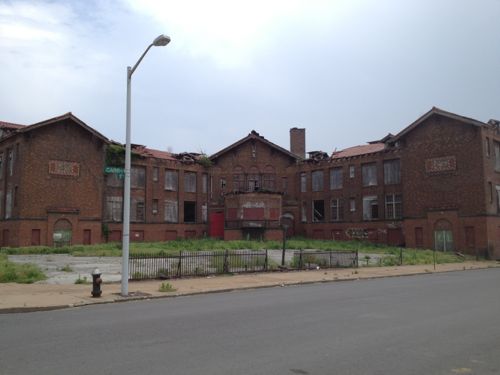
Many would love to see the crumbling Carr School get renovated. Click image for more information on this 1908 structure.
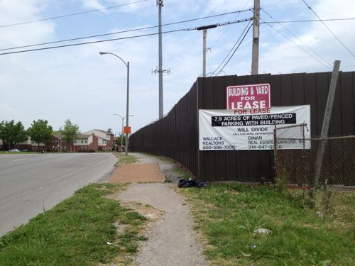
7.9 acres ready for development, the original lot boundaries remain since they were never consolidated.
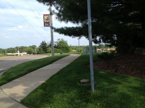
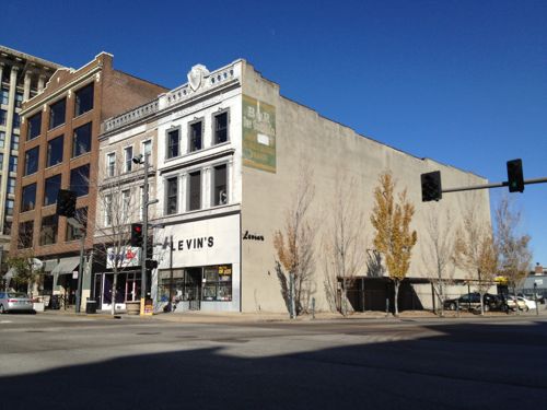
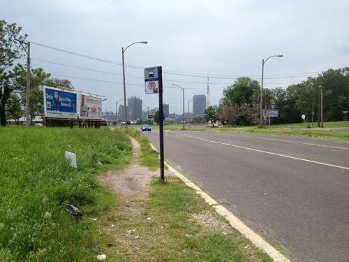
The 14th & O’Fallon St bus stop is always busy, but that hasn’t spurred development to date. This stop is currently served by the #32 & #74 MetroBus routes
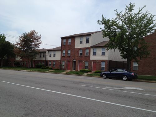
On the west side of 14th, south of Cass, is the O’Fallon Place Apartments owned by McCormack Baron Salazar.
Looking NW on N. Florissant from 14th, vacant land and mostly vacant buildings are all around.
The Mullaphy Emigrant Home at 1609 N. 14th could finally get renovated if the streetcar connects the near-north side to downtown. Click image for more information on this historic structure.
Looking back toward downtown we see evidence of disinvested in the area along N. Florissant near Madison St. The city says property owners are responsible for sidewalks but in this case the city is the property owner.
The City of St. Louis is the legal owner of the 668 sq ft wedge-shaped lot at 1458 Madison St.
This small building at 2100 N. Florissant Ave was built in 1906, the owner is in St. Louis County.
A bank in Illinois now owns the unfinished daycare at 1501 Clinton & 1500 Monroe. The buildings to the north are owned by several owners, including the LRA & Northside Regeneration.
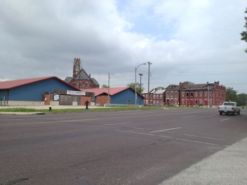
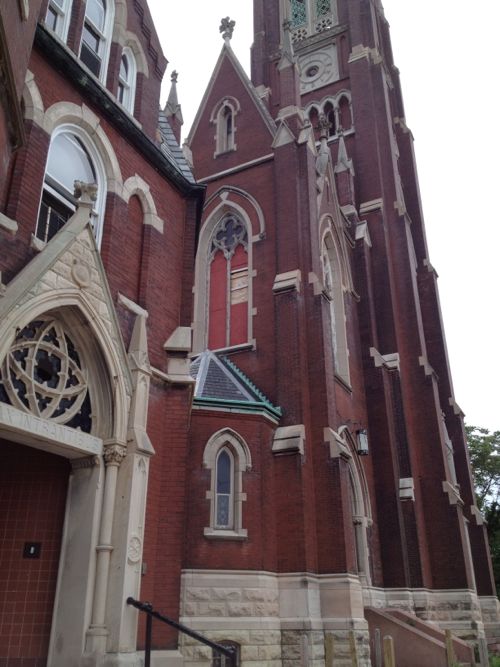
The mostly vacant St. Liborious complex at Hogan & North Market is a city landmark, it is privately owned. Click image for more information.
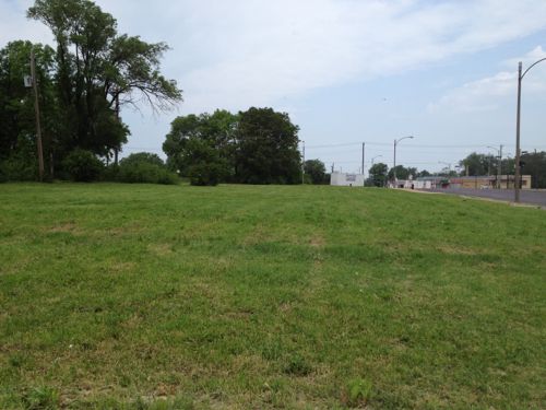
Vast open areas are prime for redevelopment along the proposed streetcar route. This is north of North Market on the west side of North Florissant
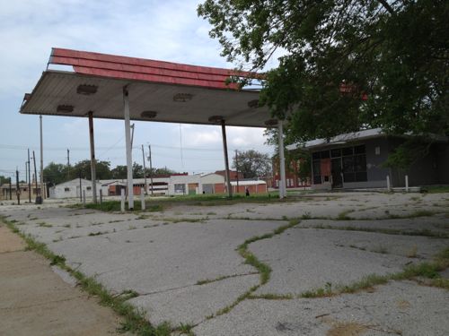
The vacant gas station at 2418 N. Florissant was built in 1972.
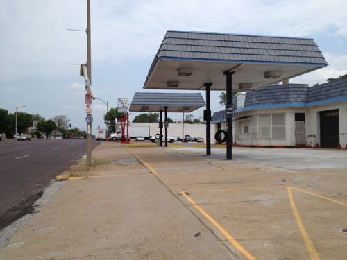
Two blocks north at 2618 N. Florissant is another vacant gas station, this building has been modified many times since 1938.
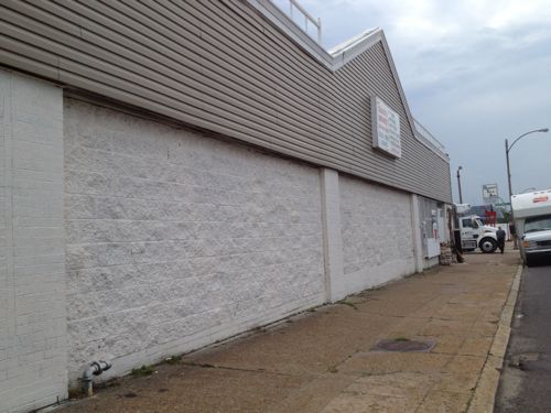
This building, owned by a person in Atlanta GA, needs to be replaced. The Church’s Chicken could operate out of a storefront in a new building.
This building from 1940 should be replaced.
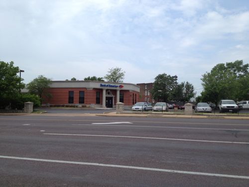
This bank was built in 1993 after the urban bank at the corner of N. Florissant & St. Louis Ave was razed, despite neighborhood objections. This should be replaced with an urban building on the corner.
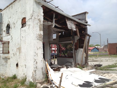
The NE corner of N. Florissant & St. Louis Ave. had a cute diner until 1998
With so much vacant land & buildings, this stretch of the proposed streetcar line has the greatest potential for redevelopment. It will also be a challenge initially to get projects funded. Once the line is open and Paul McKee builds one of his job centers near Tucker & Cass things will start to take off. Form-based codes requiring dense urban design will be key to getting the right kind of construction.
It’ll take at least a decade, if not two, for this to be built out.
In a previous poll I asked about favorite brewery, but excluded brew pubs. This week I want to find out the brew pubs favored by readers. This time I think I have all listed, but if not you can add an answer when taking the poll.
The poll is in the right sidebar until May 26th, results presented May 29th.
AARP Livibility Index
The Livability Index scores neighborhoods and communities across the U.S. for the services and amenities that impact your life the most
Built St. Louis
historic architecture of St. Louis, Missouri – mourning the losses, celebrating the survivors.
Geo St. Louis
a guide to geospatial data about the City of St. Louis